Create a free profile to get unlimited access to exclusive videos, sweepstakes, and more!
We now have official high-resolution maps of Pluto and Charon
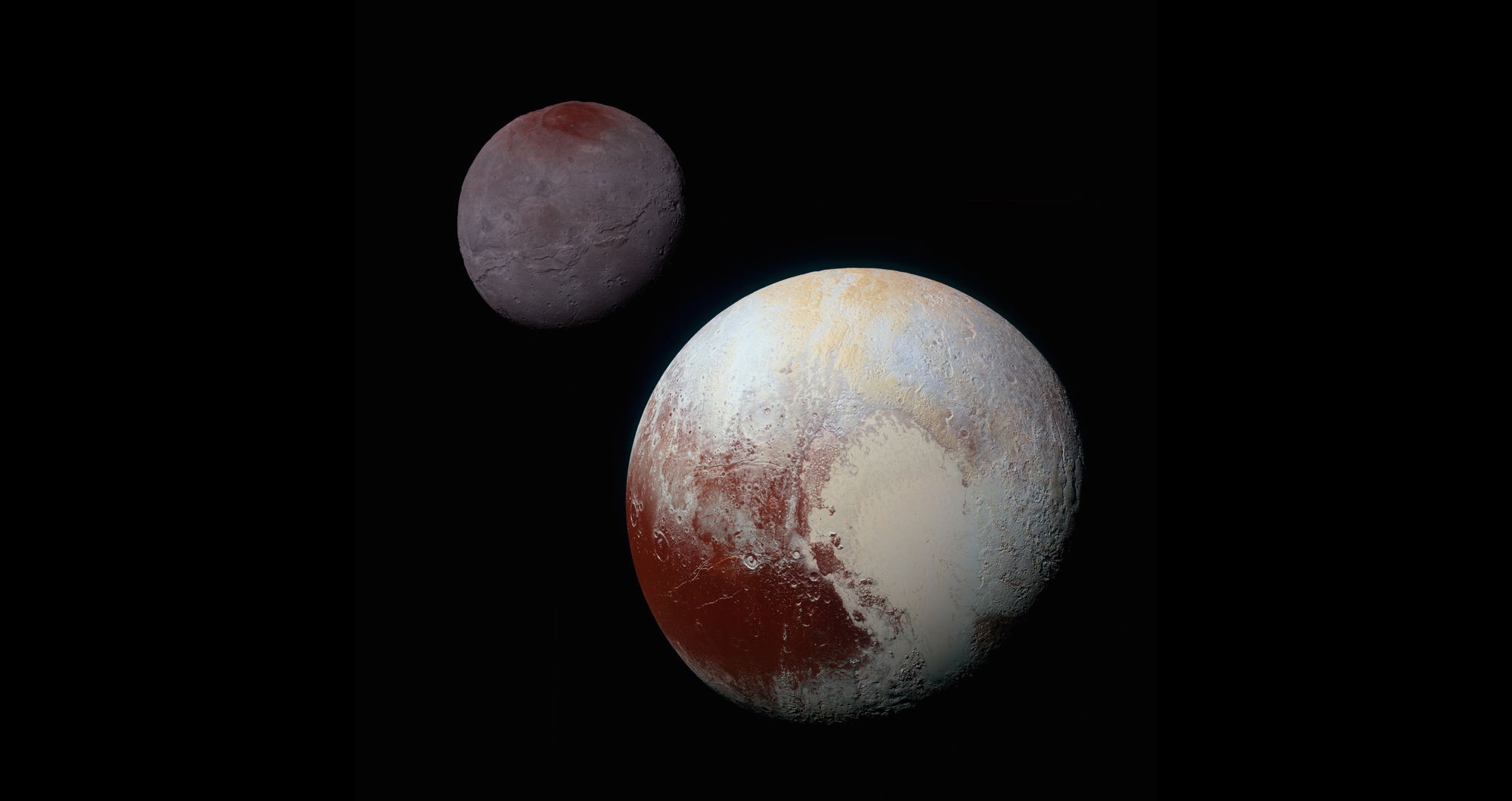
Three years ago tomorrow — on July 14, 2015 — the New Horizons spacecraft shot past Pluto at a velocity of 13.8 kilometers per second (very nearly 50,000 kilometers per hour). At closest approach it was only 12,500 km above the icy world's surface, which is incredible given the 5 billion km it had traveled to get there!
Just in time for the anniversary, the New Horizons team has published both global and topographic (elevation) high-resolution maps of Pluto and its moon Charon, the first of their kind that have been officially validated. The Charon images have resolution down to about 1.5 kilometers per pixel, while some areas of Pluto were seen at a staggering 70 meters per pixel!
The maps are available at NASA's Planetary Data System, but I'll note they take some experience to use. My friend Emily Lakdawalla has online tutorials on how to process them (including an 88 Mb video tutorial you can download). I haven't played with them, to be honest — as an old hand at image processing, I'm actually a little reticent to: I know I'll wind up spending the next two weeks without sleeping obsessively poking around the maps. But I imagine a lot of people will have a lot of fun digging around in them.
The maps have variable resolution, because New Horizons zipped by so quickly it only effectively saw one half of each world, and it saw some parts better than others. While it did turn around after the flyby and take images of the "back" sides, those were the unilluminated halves, so not much was seen. However, because Pluto has an atmosphere (though very thin), scattered light did softly illuminate part of the night side, so about 78% of Pluto's surface was seen.
The methodology and results for Pluto and Charon were published in two papers in the planetary science journal Icarus, if you're curious about the very technical details. Some of the highlights are pretty interesting…
For example, Sputnik Planitia (the left side of Pluto's "heart") is 2.5 – 3.5 km deep as measured from the rim. That makes it a pretty significant basin! On its western flank are huge massifs (groups of mountains) that sport the steepest slopes on Pluto, some of which are at a 40 – 50° grade.
Although it's not obvious at all from the images, there's a system of ridges and troughs that runs north-south across the entire mapped face of Pluto, west of Sputnik, that is 300-400 km wide and at least 3,200 km long. It's literally pole-to-pole, at least. It may extend along the side of Pluto not seen well by New Horizons, too. What could cause such a tremendous feature? It's not clear. It's likely tectonic, somehow. Pluto's crust has expanded due to undersurface liquid (likely water) freezing, called extensional deformation. That could tear the crust along a line, creating such a feature. No one's sure.
Another mystery lies at the north pole. There's a dome there 2-3 km high and 600 km wide. That's pretty dang big. It's not at all clear what it is. It could be thicker crust there, possibly due to accumulation of material over time. But if that's the case, it would make Pluto wobble as it rotates, ending up with it tipping over and flipping the dome from being at Pluto's pole to being at the equator. That would also be true if it's an ancient shield volcano, or some sort of uplift feature due to internal upwelling. So why it's where it is, frankly, is weird.
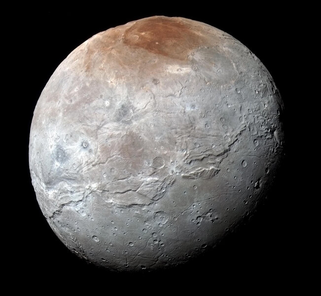
But not nearly as weird as Charon, Pluto's oversized moon. I've always said it looks like Frankenstein's moon, as if it had been broken apart and slapped back together.
That's not too far off. New Horizons data allowed scientists to make elevation models for about 40% of its surface, and the difference between the northern and southern hemispheres is as distinct as they appear in images.
The northern hemisphere is broken up into huge polygon-shaped blocks that are bounded by troughs up to 13 km deep, the deepest features on Charon. These blocks can form when the crust fractures (possibly due to expansion, similar to Pluto's) and liquid underneath extrudes between them. The tallest features in the reach 5-6 km high, so there's an elevation swing of up to 19 km across the moon, which is more than any other mid-sized object mapped in the solar system (except Saturn's moon Iapetus, which has its own weirdnesses).
The southern hemisphere of Charon is completely different. The wide plains, broadly and informally called Vulcan Planitia (yes, after Star Trek) are much smoother, the structure dominated by the processes of tectonics and resurfacing. It's possible there were cryovolcanoes — volcanoes that spew liquid water instead of molten rock like on Earth — which then flooded the region. But there are also massifs in Vulcan Planitia, which make this less likely. It's possible there was crustal breakup there too, but the blocks foundered (collapsed), so that liquid water underneath them extruded up, flooding the area. The massifs are then what's left of the blocks just breaching the surface, the parts that weren't subsumed.
That's so cool! But like so much in the Pluto system, it's not clear what's what. We only got this one glimpse! All that's left to do is study the information returned over those billions of kilometers from New Horizons, and try to puzzle out what forces sculpted these bizarre worlds. It may be decades before we see them up close again, so maps like these will be crucial for planetary scientists to use and guide them around the twisted and jumbled topography, on their journey toward understanding these frigid little worlds.

